| ||||||||||||||||||||||||||
Contents
Click on the item to go to the article. |
Editorial CommentIt is good to hear that an action group has been set up to look to the future of the Town Hall. It is also very pleasing that some of the trustees are Society members and we hope all of our membership will give the trustees support for the task that lies ahead, which may not be an easy one.
Deadline for copy for the spring edition is Wednesday 18th January. |
Forthcoming Events
| 2012 | ||
| Date and Time | Event | Venue or Meeting Point |
| Tuesday 17th January 19:30 |
New Year Social and Quiz – Please bring a plate of food (if you can) – Drink provided. Subs for 2012 may be paid this evening. |
Haden Room, United Church, Church Street, Trowbridge. |
| Tuesday 13th March 19:15 |
Annual General Meeting and Talk - “Organised Crime, Crime Waves and Thieves in Hoodies - Crime in the Middle Ages” | Haden Room, United Church, Church Street, Trowbridge. |
To arrange for a lift or to volunteer to car share please contact Glyn on 755784
FROM THE CHAIRMAN
I should like to thank those members who responded to the appeal in the Summer Newsletter. Kevin and Sue Eames have volunteered to assist Margaret Howard reviewing planning applications, Peter and Jenny Collier in preparing the Newsletter and Janet Carpenter is assisting our treasurer Kay Austin.
Mary Pearce, one of our Vice Presidents, called a public meeting on the 23rd September for all those who are interested and concerned about the future use of the Town Hall. It was a good meeting and several people agreed to join a trust with the aim of taking over the Town Hall and using it as a centre for the creative arts in Trowbridge with the main hall available for general use. It would be a sad day if the Town Hall became yet another pub or restaurant so we must do all we can to support this group.
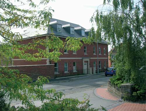
The Poundbury and Dorchester trip proved a great success, and our thanks to Celia Russell who organized the visit. What I noticed, and no doubt many others did too, was the fact that wherever you looked there was a pleasing vista which is more than can be said about the new development at the end of The Halve. What is it about our planning officers that they are apparently happy with this depressing kind of architecture? It seems that almost anything will do for Trowbridge. I cannot imagine the planners in Bath being satisfied with such a dull building in such a prominent position.
You may have read in the press of the proposed developments on the Bowyer and old Tesco sites. While both of the areas urgently need developing I do hope we get something better than the Sainsbury's building. I can't imagine how the proposed extension on stilts at Asda's store can possibly do anything to improve the riverside area. The extension would be directly opposite some of our most important industrial heritage and so would need to be something special.
Planning Matters
Very little of special interest has happened since the last newsletter, but presentations have recently been made about three projects. Planning applications will be submitted very shortly Asda/Wallmart wish to enlarge their store to compete with Tesco and Sainsbury. Their site is restricted so the planned extension would be along the River Biss corridor.
Prorus bought the Bowyers site 2 months ago and plan to develop it with a Morrison's supermarket. This will fully fund a 6 screen cinema, renovation of listed buildings to accommodate 6 restaurants, and enhancement of the River Biss corridor. They mention the possibility of a rail/bus interchange. They are ready to start, if permission is given, with a 2013 completion.
Legal and General own the ‘Mount Crushmore’ (Old Tesco) site and plan an 8 screen cinema, 6 restaurants and an 80 bed hotel. This is fully funded by another L&G division and is deliverable in 2 years from planning permission. They could acquire the Peter Black site as well.
Heritage Open Days 2011
This year there were 14 openings or events, quite an increase since our first year in 1996, when we only opened the Blind House. Visitors from as far away as the Midlands and Cornwall came to Trowbridge especially for Heritage Open Day. The blind House had 185 visitors against 192 last year, 39 people climbed St James Church tower to see the bells, double last years total. This was partly due to the fact that most of the 20 participants on Ken Rogers' Weaving Walk arrived at the tower just in time!
Zion chapel had 42 visitors to see the display of King James bibles, to listen to readings from it, to tour the building or to listen to Heather Skull's short recital of scriptural songs.
The United Church displayed over 30 different translations of the bible as well as several transliterations. The museum had a copy of the 1611 King James Bible that was printed in the 1600s. Fabric Magic hosted a drop in session for people to do some knitting, a reminder that Trowbridge was a woollen town. The talks were less well attended attracting 8 and 13 visitors.
Trowbridge Community Area Future Partnership (TCAF)
TCAF is a Community Area Partnership (CAP) which is a local, independent and non-political body and acts as a representative voice of the community. Our area covers Hilperton, North Bradley, Southwick, Trowbridge and West Ashton. TCAF brings together representatives from across the entire community.
Our Partners include elected representatives and officers from Wiltshire Council, NHS Wiltshire, local GPs, Wiltshire Police, Wiltshire Fire & Rescue, Trowbridge Town Council, the Parish Councils of Hilperton, North Bradley, Southwick and West Ashton, Wiltshire College, the 3 Secondary Colleges/Schools and the Primary Schools, Early years and youth groups, Housing societies and community and residents groups, Transforming Trowbridge, the Business Community, Trowbridge & District Chamber of Commerce, transport providers, and the general public. TCAF links with representatives from across the community to prepare a long term Community Area Action Plan. Our present Plan for 2004 - 2014 has recently been replaced by a shorter plan 2011 - 2016. (see press release. Eds).
The aim of the plan is to improve the quality of life for all who live, work or visit our Community.. Area.
The following 8 themes have been adopted by the Partnership to create a framework for drawing the Community Plan together and 5 theme groups have been established:
- Economy and Transport which has Bob Brice as its Champion.
- BA14 Culture which had Mary Stacey as its Champion.
- LEAF the Environment Group which has Doug Ross as its interim Champion. (John Austin has been a member.)
- Health and Social Care which has Margaret Howard as its Champion.
- Safer Trowbridge the Community Safety Group which has Dave Cullop as its Champion.
- Housing and the built environment does not have a Theme Group but we work closely with Wiltshire Council's Housing Department and with local Housing Societies particularly Selwood Housing.(surely the Society should be represented? Eds)
- Sport is being dealt with separately from Culture and presently we are working with the Trowbridge Outdoor Pitches Group and Active Trowbridge.
- Education is being addressed through membership of the Trowbridge Extended Services Network.
In addition a Parish Councils' Liaison Group and a Trowbridge Neighbourhoods Partnership have been formed to consider and address their particular local issues.
On the original plan although some key targets have been achieved, there was a major setback with the collapse of the Waterside Development. Nevertheless the development of this area will remain a key aspiration. Already started is a new “state of the art” Library and Wiltshire Council intends a Swimming Pool and Sports Centre. As you know there are new proposals for the former Bowyers and Tesco sites.
The new Plan will be displayed on our website, in the Library, in the Town and Parish Council Offices, in the College and local schools and at other partners’ premises. (Abstracts from the web pages could be a regular feature in the Newsletter. Eds)
We are always keen to attract new members for all our Theme Groups from local people interested in a particular theme or themes. Anyone wishing to join please contact one of our Project Officers Kate Oatley or Tracy Sullivan on 01225 765072 or by email at tcaf@trowbridge.gov.uk. (Each theme group needs a volunteer minute taker, not an onerous task and an excellent way of contributing. How about it? Eds)
IMPORTANT PRESS RELEASE FOR THE NEWSLETTERSeptember 2011Trowbridge Community Area Future (TCAF) has produced the Community Area Plan for Trowbridge The plan runs from 2011 until 2016 and is available to view at www.tcaf.org.uk For a copy of the plan, please contact Project Officer Kate Oatley or Tracy Sullivan on 01225 765072 or via email at tcaf@trowbridge.gov.uk |
| Corporate members: | Coleman & Starkey Family Dental Practice, Timbrell Street. The Trowbridge Museum. |
Website AddressesThere are many organisations, local, national and international which campaign for a better natural and built environment. Below is a selection of some of these organisations. It is intended to publish more in the next newsletter. If you have any favourites, pass them on to the editor.
|
A Word from the Treasurer
As you will have read in the Chairman's report Janet Carpenter has volunteered to cover for me if I am away at any time. This situation has changed as John and I are shortly moving to Surrey to live nearer our family. Janet has agreed to be the Acting Treasurer until the AGM when she can officially stand to be nominated as Treasurer. Janet is very experienced in keeping accounts and I am confident the Society's finance will be in good hands.
On another matter, the Society received an anonymous donation of £1000 with the condition that it be spent on financing a set of mayoral robes for the town. This the committee agreed to do, no longer will Trowbridge look the poor relation during official functions.
West Wiltshire U3A Architecture Group
The U3A is a national movement with about half a million members. It is an organisation for retired or semi-retired people, who meet in various groups to follow subjects in which they have a particular interest. West Wilts U3A covers Bradford on Avon, Melksham and Trowbridge.
The objective of the Architecture group is to develop our interest in buildings so that we will appreciate better the positive aspects of our built environment. We are lucky in living in an area with great historical buildings which, with some newer ones, will allow us to study a lengthy period of permanent buildings in Britain. At its first meeting in January 2011, the Group started off with great enthusiasm, discussing the buildings liked and disliked in Trowbridge. There was general approval of its many lovely old buildings. Surprisingly the most chosen dislike was the Police Station, not mainly for the design but for not fitting in with the old attractive buildings nearby. There were adverse comments about a number of other buildings such as the post office and the QS Extra shop and I would like to think that in time we might be able to come up with suggestions for some improvements at affordable cost.
Those interested in further details can contact David on 01225 754688.
 Whither Urban Design
‘Go east young man!’
Ian is a town planner and historic building expert with a great deal of experience in assessing new developments in sensitive locations. Here is what he thought.(PC).
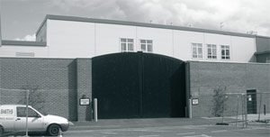
A new supermarket lies at the heart of the redevelopment scheme. Starting in Church Street, where the site butts up to the conservation area, there is an enticing and reasonably attractive pedestrian link with the town centre, although this could benefit from more interesting shop fronts, activities and greater vitality. Moving around the edge of the site in a clockwise direction the frontage presented to the Conigre is disappointing with tall, fortress-like gates enclosing a service yard. This might have been a better location for housing development to complement the Conigre Square scheme opposite.
Further up the hill at the corner with British Row the interface of the development with the public street is positively dull with blank walls facing this entrance to the town centre. Following around into British Row is the first indication that this is not a purely retailing project. A tall terrace of new housing juts up opposite long-established two storey houses. Here the design seems disjointed. It's not just the height and abruptness of the terrace that seems misplaced. The architectural design concept is ... industrial utility meets down town New Orleans!
Sites that lack a clear architectural context do offer designers greater flexibility, and these are not the places for architectural dogma, but this part of the scheme is not an obvious townscape success. At the time planning permission was being granted for this scheme government advice was:
Design which is inappropriate in its context, or which fails to take the opportunities available for improving the character and quality of an area and the way it functions, should not be accepted.
Was this a case of new development being welcomed at too low a threshold? The development and planning industries are starved of resources and the Coalition government's response has been to announce simplified policy proposals 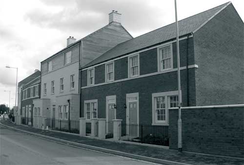 aimed at stimulating growth. Trowbridge desperately needs higher quality development; but not development at any cost. It is difficult to see how these new measures will help drive up standards in urban design.
The entrance facade of the supermarket itself consists of honest, twenty first century functionality. It is extremely difficult to arrive at a sympathetic appearance for such large scale structures - neither the neovernacular style of the town's Tesco store, or the crinkly tin shed approach of the Asda supermarket seems an appropriate template. The new Sainsbury store lacks charm both externally, and internally, but its construction has helped with the regeneration of a once despondent part of the town. The site layout, however, might have been better. The frontage to British Row seems to be crying out for modest residential development. This would have been preferable to wide open gash that opens up views into the sprawling car park. As it is, the landscaping appears perfunctory and it is a regret that the opportunity was not taken to have the ugly overhead wires placed underground. The new roundabout also seems to disrupt British Row as a cohesive urban street, adding to a sense of car domination.
Further along British Row, where it merges with Prospect Place, there is better news. The final abandonment of the highway engineers' dream of an inner relief road has lifted the blight from left-over land. A substantial number of new houses and apartments have been built on the disused land re-establishing Prospect Place as a decent place to live. Moving eastwards the first new building on the south side of the street is Poplar House. Its design is not wholly convincing; it is not quite clear whether it is seeking to harmonise with the pattern of the adjacent 20th century, hip-roofed terraces, or does the classical front door surround suggest it was really trying to take up the proportions of an 18th century townhouse?
Further east again, is a more harmonious addition to the architecture of the town. A terrace of brick and (artificial) stone provides an attractive and human-scale, interface with the public realm. Moving on towards the junction with Timbrell Street, the mass and scale of the buildings increase. This is acceptable at a key nodal point within the town, and the use of contrasting external materials for the top storey is a nod to the sustainability agenda that echoes the weaving lofts found in traditional buildings that encircle the town centre.
 The new terraces in Prospect Place and Timbrell Street intersect at the Palmer Gardens roundabout. It is often difficult to find a design that ‘turns the corner’ happily and the re-entrant angle used here produces some awkward relationships, particularly at the rear where the meeting is extremely cumbersome.
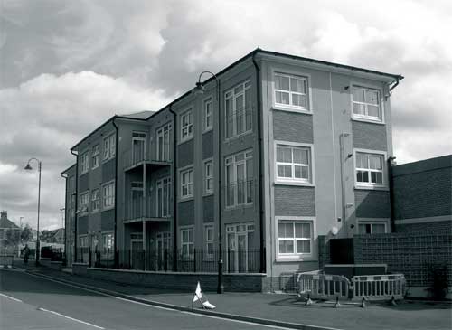
The unfriendly blank walls, gates, and gaps created by the supermarket development is disappointing and the design of the adjacent three storey terrace of flats is frankly out of place.
However, the rebuilding of Prospect Place, only a short distance away, demonstrates how careful urban design rooted in an understanding of local character can help assimilate new development into the wider context within which it fits.
Mystery Stones
I was interested to see on a 6 inch Ordnance Survey map (revised 1922) several references to ‘Stone(s)’ in the Hilperton Road area. I was further intrigued as one of them is on our property. A query to the OS was not too helpful, merely that ‘a surveyor would have plotted the “Stones” as a physical feature. There is no suggestion as to their purpose’. I also drew blanks with the Wiltshire Heritage Museum and the History Centre in Chippenham. However Google came up with the following: ‘A boundary marker, boundary stone or border stone is a robust physical marker that identifies the start of a land boundary or the change in a boundary, especially a change in direction of a boundary. They have often been used to mark critical points on boundaries between countries or local administration but have also been used to mark out the limits of private land holdings, especially in areas where fences or walls are impractical 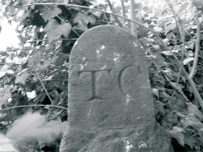 or unnecessary. Boundary markers are often made of stone and are typically placed at a notable or especially visible point Many are inscribed with relevant information such as the abbreviation of the boundary holder, and often a date.
Boundary markers may be used to mark property boundaries (land-ownership) or political boundaries.’ It seemed to me that because of their seemingly random positioning these stones were more likely to be some sort of boundary marker rather than milestones or marking political boundaries. But what boundaries would they be marking and what age would they be?
or unnecessary. Boundary markers are often made of stone and are typically placed at a notable or especially visible point Many are inscribed with relevant information such as the abbreviation of the boundary holder, and often a date.
Boundary markers may be used to mark property boundaries (land-ownership) or political boundaries.’ It seemed to me that because of their seemingly random positioning these stones were more likely to be some sort of boundary marker rather than milestones or marking political boundaries. But what boundaries would they be marking and what age would they be?
Open fields appear to have been developed in the Medieval period. Each village would be surrounded by several large open fields, usually not physically divided from each other, with each field containing a different crop as part of a three-field crop rotation. The fields would be split into sections a furlong wide, each of which would be sub-divided crosswise into strips covering an area of half an acre or less. Under their commoners' rights, each villager was allocated a set number of strips and the individual holdings were scattered so that no individual ended up with all good or bad land. There also would be large common meadows (allocated in strips in a similar way) and common pasture land or waste, where the villagers would graze their livestock.
So could these stones have been used to mark boundaries within the open-field system or could they have been concerned with the much later Enclosure Acts? I am not sure how many of the Hilperton Road stones are still in place or visible. Until the end of the 18th century the main route towards Hilperton was via Middle Lane and apart from farming, there would have been little to disturb the stones. The stone in our garden is horizontal and half buried and I am unable to ascertain whether there is any inscription, although there is no doubt that the stone itself has been worked. I am reminded of Proverbs 23 verse 10: ‘Do not move an ancient boundary stone or encroach on the fields of the fatherless’. The last thing I want is a plague of locusts falling on Hilperton Road!
Postscript: Since writing this article the stone has been excavated and placed upright, revealing at the top on one side the carved initials ‘TC’. According to our title deeds the adjoining land, being part of what was known as Lord's Furlong, was at one time in the ownership of Thomas Clark. One can only conclude that he used this stone to mark his boundary. However while the top is finely chiselled the lower part is crudely worked with very weathered crenellations on each edge. TC presumably recycled an ancient, maybe medieval, stone for a contemporary use. The other stones in the Hilperton Road area will doubtless hold other stories.
| Welcome to the following new member: | Mike Bloomfield |
Newtown Conservation Trail
In 1991 Michael Lansdown wrote the Newtown Conservation Trail for the newly-formed Newtown Area Residents' Association. It is a guide to the streets and buildings of the area. This has long been out of print and it is hoped that it might be re-printed in the future.The following is a much-shortened version (PC).
This area of Trowbridge was built from about 1800 to 1900, but most houses were erected from 1860 onwards. It was a compact neighbourhood with a wide mix of social and economic classes. With generous back gardens to mainly terraced houses, the overall density is about 15 to the acre. The visitor will be pulled up now and then by jarring notes: inappropriate additions, replacement windows and doors and ‘cladding’, but the area as a whole has a character truly worthy of conservation. The area is named from the street now called Newtown, but it was earlier named, Pilewell'. About 1790 a three storey terrace for mill workers was built on the west side of what is now Newtown. The great open West Field, which lay to the west of this lane was originally cultivated in strips by the townsfolk. The strips ran roughly north-south and when the field was enclosed in the 18th and 19th centuries the new fields were bounded by hedges following the direction of the strips. As one field after another was developed with suburban housing the layout of the streets followed the lines of the hedges.The Newtown area echoes in its layout the strip fields of medieval times. The houses on the east side of Newtown were not developed until 1892, a hundred years after the first houses opposite them. This was because the Bythesea family, who owned land from Newtown down to the river, held it back from development until this time. The former Co-op shop was built in 1906 by the Trowbridge Co-operative Society. There is a very fine wheatsheaf emblem carved in stone over the door by Palmer and Shepard of Bristol. The drawing for it was made by Walter W Snailum, a Trowbridge architect. Opposite is the brick-built Labour Club of 1924 by the same architect. On the other side of Gloucester Road from the old Co-op is Bethesda Baptist church built in 1930, also by Snailum. Several houses along Newtown were pulled down in 1930 and replaced by the advertising hoarding. Beyond this are the original 1790 ish houses. Number 14 was refronted when it was the Rising Sun. Number 26 has its original rubble front. Across the road one can see subtle differences of detail in what look like uniform terraces - shapes of doors, windows and bays and their arrangement; flat lintels or arches; carved foliage ornament. Small builders would buy a few plots, build a few houses and after they had been sold take a few more lots along the road.
Pilewell Terrace on Newtown is a rank of 16 houses with very long front gardens. They date from 1840. Park Street School, opposite where Park Farm used to be, was built in 1873 by Richard Gane junior, a Trowbridge born architect, who was also responsible for Abbey Mill, Bradford on Avon. The plain brick and stone terraces in Park Street, Bond Street and along the Frome Road date from 1865. The West End Building Society owned 6 acres of land in 54 plots. It would lend builders £15 toward a £20 plot and three quarters of the £146 cost of building a house. Such houses continue beyond Waterworks Road with the Anchor and Hope Inn in the centre. This was opposite the main gates of the Artillery Barracks and Mass was celebrated in the rear upper room of the inn for Irish and other Roman Catholic soldiers until the Catholic church was built in Wingfield Road. Waterworks Road is named after the first Trowbridge Water Company, formed 1864, which failed to get drinkable water from its deep well and pumphouse (site of Henderson Close). Bricks for the works and houses came from clay in a nearby field. In the 1870s a Bristol builder, Durke, built 54 houses ‘on the site of the waterworks’. In Gladstone Road, which is off Waterworks Road, four of the more distinctive houses (1883) are by Edward Linzey, founder of the town's leading firm of builders up to the 1960s. The others are by the builders W R Moody and T W Lyles. Between Waterworks Road and Bond Street there are three distinctive terraces running at right angles, their fronts facing long gardens and their backs facing narrow access lanes. Park Street was built mainly in the 1880s. The northern end was at one time called New Park Street. On the corner of Westbourne Road and Gloucester Road was a post office and shop - Luxfords (now converted into flats). This was built about 1890 and opened in 1892 by T H Watson. On the opposite corner is the Conservative Club established in about 1907. Close to the John of Gaunt School is the Rural Music School which seems to be by Durke with a very odd cornice like gear wheels. For many years it was the home of Henry J Knee, founder of Knees department store. The former Girls' High School dates from 1932. Gloucester Road, still called Studley Lane in the 1871 census, was meant to link with Pitman Avenue. In fact on the 1899 map Pitman Avenue was called Gloucester Road. There is still only a footpath here.
Avenue Road was ‘highest in the social hierarchy of three streets opening off Wingfield Road: West Street, Westbourne Road, Avenue, known early in this century by the irreverent nicknames of Threepenny, Sixpenny and Shilling Streets!’ The field on which the houses were built was called Tyning and was sold for building plots in 1889. The site was described as ‘the most eligible site in the town...will beeagerly sought after as houses and villa residences are in great demand’. The first houses built were ‘a pair of grand villas with four bedrooms, bathrooms, separate WCs, three reception rooms, etc.’ The builders responsible for many of the houses were Lyles (in 1911 a builder called Lyles lived for some time at number 38, presumably the same) and E Linzey. ‘Linzey had a distinctive way of turning the corners of his window bays, with two stone quoins showing alternate wide and narrow faces. His houses get grander towards the bottom, with stained glass, etc. Nos. 25 and 27, higher up, stand out with deep keystones carved with low relief foliage’. The detached houses opposite John of Gaunt School in Wingfield Road and the groups and single houses as far back as No 20 were built by Linzeys from 1890 to 1907. Some were designed by Snailum who lived at No 46. The road which now leads down to St Augustine's School was meant to link with Bradford Road as a housing development called Mornington Gardens, which came to nothing. Between Westbourne Road and West Street there is a ‘pretty little’ Victorian Terrace, dating back to the 1850s with royal heads over the doors and, at the corner of West Street, prettily patterned bricks. In 1871 Trowbridge Co-operative Society bought a field on which now stands Westbourne Road.
The earliest houses seem to be those with round-arched doors and windows and much foliage carving, by a builder named George Fluke. He, apparently, carved all the pretty leaf capitals in this and many other Trowbridge streets. The larger pairs, with battlemented bays and veranda-like porches were built from 1895 to 1898 by Lyles who lived in one. Many others also were built by Lyles. Back in Gloucester Road some of the houses have ‘strangely classical pediments’ and, almost opposite the end of West Street is an archway with a sculptured keystone of a craftsman’s head with decorator's tools. In the 1870s this was where Lyles had his yard. Later a blacksmith had it. West Street was developed from the late 1860s onwards. Facing West Street in Wingfield Road are Alexandra Villas with their odd turrets.
Next door is St John's Church, 1876 by A J Scholes and what was once its school (1935). On the opposite side is Elm Villa, with a classical doorway, two houses by Snailum (1903) and Westview Terrace (early 1870s). Finally there is the recently restored Stallards Inn (Newsletter Spring 2009) on the corner of Newtown and Wingfield Road, built about 1860. A good place to rest after this tour.
RECENT MEETINGS |
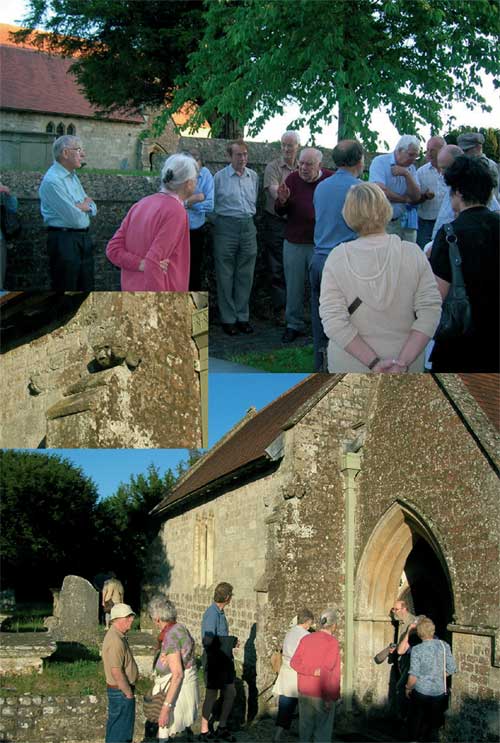
Upton Scudamore Guided Walk 3rd June 2011
Over 40 enthusiasts (Society members and Friends of the Trowbridge Museum) were greeted in St Mary's church by Ken Rogers, who 50 years ago had made a study of the village for the VCH. Glyn Bridges then gave an account of the architecture and fittings of the building including the ‘Scudamore’ Organ and the unusual end grain block flooring. During our perambulation we were struck by the many desirable houses that have appeared over the last 20 or so 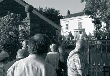 years. Among the remarkable historic buildings the standouts included Temple Manor, named after the Bishopstrow family that acquired this demesne farm in the 17th century. This 3-gabled, two storied porched house has acquired a vaguely classical new ‘front’ since Pevsner extolled its virtues. The planning discussions must have been most interesting but several of us liked it. Even more impressive is Parks Court (formerly but erroneously called the Manor), an H shaped building with two 18th century wings flanking a much older hall, originally probably open to the roof, with a central hearth. The cheerful owner of Trees Farm came out for a chat, we learned of the translocation of the pub, the purity of our (since 1873) water, the relatively brief lives of the school and Baptist chapel and much more on a beautiful evening. Many thanks to Ken, Helen and Glyn.
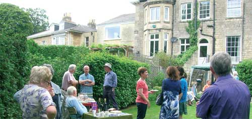
Cream Tea and Bring & Buy 2nd July 2011
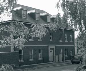
‘What is this life if full of care we have no time to stand and stare?’ These words came into my mind as I approached the very busy Hilperton Road having parked my car half way down Stancomb Avenue. I saw opposite me these wonderful late Georgian houses. Why had I not noticed them before? Because like a lot of other people I had passed by at speed, either leaving or entering Trowbridge. However my mission was to find the home of Dr and Mrs Eames, not difficult as a sign said ‘Civic Society’, guided by other signs I entered (like Alice) through a door into the peaceful and tranquil garden of our hosts.
Why? Oh yes. It was the day for our Bring & Buy event coupled with a Cream Tea (a change from coffee mornings).The weather was good and the surroundings ideal, a ‘Natural’ garden where one could relax, talk to our friends and enjoy the excellent cream tea which was prepared by the ladies of the committee who also manned the B & B stall and of course there was our good old faithful raffle which was well supported, thanks to all who donated prizes.
Finally the Society's thanks to Kevin and Sue for their hospitality and for allowing us to share their garden for the afternoon.
A visit to Poundbury and Dorchester 3rd August 2011
On a sunny morning, 53 members visited Poundbury on the outskirts of Dorchester. Totally beyond her control, Celia's plan for a guide to split the group for two tours went somewhat pear shaped. Delayed by a hospital appointment, the guide, whom Celia urgently tried to contact, did not arrive until 11.30am, so we all went together - just not what Celia had planned!
Poundbury, an experiment in urban development, is built on Duchy of Cornwall land. Construction has been in phases, for a more gradual extension of Dorchester. Phase one completed in 1993, looks much more mature than the more recent building which is expected to be fully completed by 2025. Various designs as well as different types of stone and different shades of brick have been used, with the purpose of reflecting Georgian Dorchester. Properties include private and social housing, a pre-school, a children's play area, a pub, a residential and nursing home and various venues for commercial use.
There are open green spaces, but back gardens are small, and residents are not allowed to hang out washing. Based on the notion that cars would not be needed if people worked locally, and to reflect the Georgian era, very few properties have garages and street parking is inevitable. The 18th century type street lamps are designed so that the light shines only onto the ground. Other interesting features are replicated, like wide archways through which carriages would have passed, and above one sits the belfry from the former Beaminster and Netherway Grammar School (1897-1962). All the properties have plenty of light despite the smallish windows, but there are some ‘blind’ windows, just as there were in the 18th century.
We saw very few people about during our visit, so we were unable to experience any feeling of a flourishing community. Hopefully this will improve as the development matures. Afterwards we had free time in Dorchester.
Thank you Celia for arranging this visit, which was a very memorable day.